

Flooding Can Happen Anywhere: How to Stay Aware, Stay Safe, and Stay Ready

Disclaimer: The views expressed in this article are solely my own and do not reflect those of any public agency, employer, or affiliated organization. This blog aims to educate and empower readers through objective geographic and planning insights, fostering informed discussion on global and regional issues

Flooding Is Closer Than You Think
Flooding is the most common—and deadliest—natural disaster in the United States. It strikes homes, parks, workplaces, and vacation spots, often with little warning. From urban streets to rural campgrounds, every community faces some level of flood risk.
The recent tragedy at Camp Mystic in Kerr County, Texas, shows how real and devastating this danger can be. A portion of the camp is located within FEMA Zone AE and the regulatory floodway, areas with significant flood risk and development restrictions.

That heartbreaking account reminds us: flood risk is not theoretical. It’s present, it’s growing, and it affects places we cherish.
Flash Floods Are Fast and Fatal
Flash floods are especially dangerous because they can happen with little warning, often during intense storms or when drainage systems are overwhelmed. In Texas alone, recent flash floods have claimed lives and left many missing.
Just six inches of moving water can knock an adult off their feet. Just one foot of water can sweep away a car. Many fatalities occur in vehicles—especially at night, when floodwaters may be invisible.
The widely shared advice “Turn Around, Don’t Drown” is more than a slogan. It saves lives.
What Flood Maps Do—and Don’t—Tell You
FEMA’s Flood Insurance Rate Maps (FIRMs) are foundational tools for understanding flood risk. But they’re not perfect.
How to Check Your Risk:
Access Maps: Visit FEMA’s Flood Map Service Center and enter your property’s address.
Understand Your Zone: High-risk zones (A, AE, AH, AO, V, VE) face a 1% annual chance flood—formerly called the "100-year flood." Over a 30-year mortgage, that’s a 26% chance of flooding (1 in 4 odds).

Limitations to Know:
Zone A designations indicate high-risk areas, but often lack Base Flood Elevations (BFEs). This makes it difficult to determine how deep water might get during a flood or how high to elevate a structure.
Regulatory floodways are the most dangerous parts of the floodplain. Development in these zones is highly restricted, and for good reason: they carry fast-moving water during floods and pose extreme risk to life and property.
Many maps are outdated, based on past conditions and not reflective of current climate, development, or rainfall patterns.

The portion of Camp Mystic located within the regulatory floodway illustrates the critical need for better mapping and public awareness. Accurate, modern flood maps are key to resilience, yet the process remains chronically underfunded.
We must do better—for our residents, for our infrastructure, and for our future.
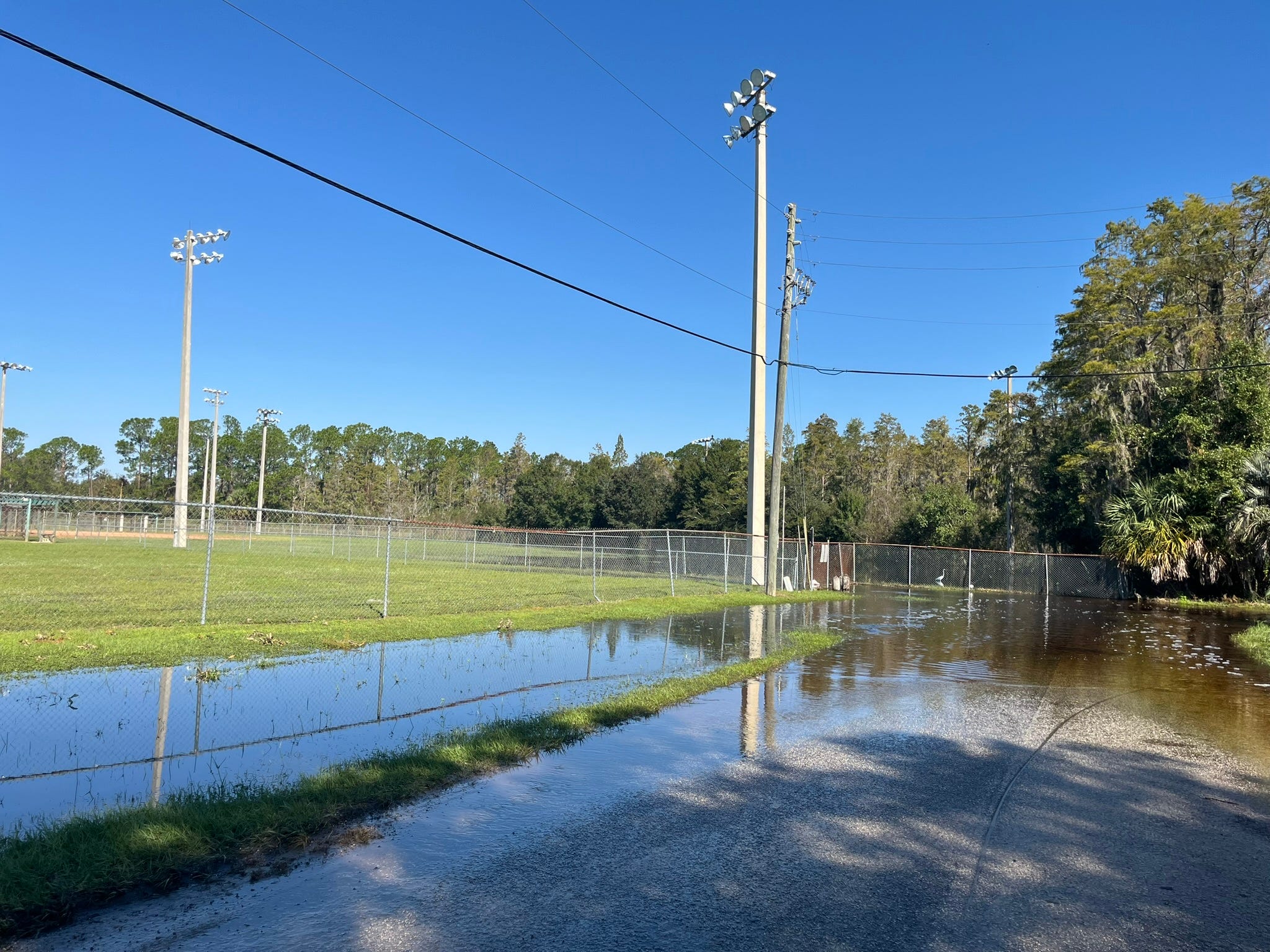
Flood Risk Is Everywhere—Not Just on the Coast
Flooding doesn’t require a hurricane or a river. It can come from:
Heavy rainfall
Overflowing ditches or culverts
Blocked storm drains
Rapid snowmelt
Urban development that removes natural drainage
This means:
A neighborhood on a hill can still flood if runoff collects below.
A park or trail may flood during storms, even if it’s never listed on a FEMA map.
A home outside a mapped flood zone can still face significant risk. In fact, more than 20% of flood insurance claims come from properties outside high-risk zones.
Did you know a “100-year flood” has a 26% chance of hitting during a 30-year mortgage?
Flooding follows topography, not property lines.
Protect What Matters: Simple Steps You Can Take Today
Where you live
Look up your FEMA Flood zone
Ask your local floodplain administrator about regulatory floodways, elevation requirements, or recent map updates
Consider flood insurance, even if it’s not required—especially in Zone A areas without detailed elevation data
Where you work
Understand if your building lies in a floodplain or low-lying area
Encourage your employer to have an emergency flood plan
Back up important documents and data off-site
Where you play
Avoid setting up camp or parking near dry creek beds or low areas
Check local conditions before hiking, biking, or boating during storm season

Whether it's your home, a school, a job site, or a beloved summer camp, every location has a flood story—if you take the time to ask.
Conclusion: A Call for Resilience
As a planner and floodplain manager, I’ve seen firsthand the cost of outdated maps, poor communication, and underprepared communities. The tragedy at Camp Mystic reminds us that flood risk is not a distant possibility—but a present and growing threat.
We must act—with clarity, urgency, and compassion.
Update outdated flood maps to reflect real, on-the-ground conditions
Improve risk communication so the public understands where danger lies and how to respond
Strengthen community resilience through better building standards, planning decisions, and outreach
Equip families, schools, and businesses with the tools to make safer choices
Flooding may be part of our natural systems. But disasters happen when we ignore risk and delay action.
If this article helped you understand flood risk better, share it with someone you care about. Prepared communities start with informed individuals
Let’s choose to be informed. Let’s choose to be ready. Lives depend on it.
Disclaimer: The views expressed in this article are solely my own and do not reflect those of my employer